During the BeGeo conference dedicated to geographical information, the GeoSpatial Award 2016 for the best professional project went to the BruGIS Urban Analysis of the Brussels Regional Public Service.
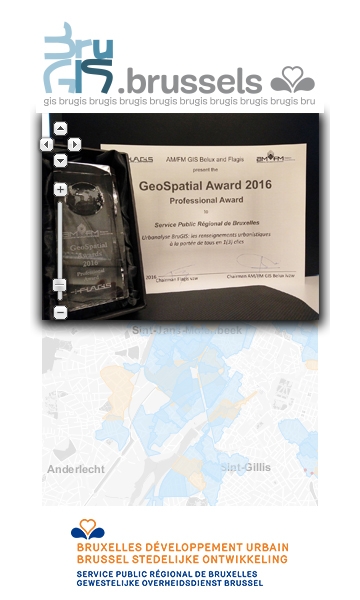
GeoSpatial Award 2016 - Professional Award presented to the Brussels Regional Public Service on 3 March 2016 for the BruGIS Urban Analysis: urban development information within everyone's reach in 1(3) clicks.
The BeGeo conference was held on 3 March 2016 at THE EGG site in Brussels.
In the context of this conference, AM/FM-GIS Belux and FLAGIS organised the GeoSpatial Awards 2016. One of these Geospatial Awards was to be awarded to a professional initiative using geographical data.
The BruGIS team from the Administrative and Financial Department (Brussels Urban Development) presented the "BruGIS Urban Analysis: urban development information within everyone's reach in 1(3) clicks".
Following an initial selection out of 14 projects, the BruGIS team were invited to present their project at BeGeo, along with 4 other professional projects, in Pecha Kucha style (short presentation of 20 slides each with a duration of 20 seconds). This Pecha Kucha was highly appreciated by the jury, which was made up of industry professionals, and in the end they awarded the GeoSpatial Award for the best professional project to the BruGIS team from the Administrative and Financial Department.
If you want to test this Urban Analysis tool, it is available on the website
www.brugis.brussels